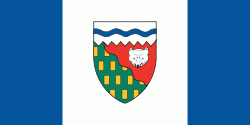
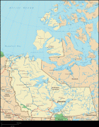
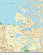
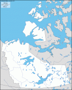
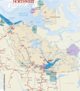
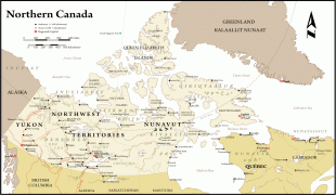
Northwest Territories (Northwest Territories)
 |
 |
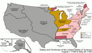
The Northwest Territories, a portion of the old North-Western Territory, entered the Canadian Confederation on July 15, 1870. Since then, the territory has been divided four times to create new provinces and territories or enlarge existing ones. Its current borders date from April 1, 1999, when the territory's size was decreased again by the creation of a new territory of Nunavut to the east, through the Nunavut Act and the Nunavut Land Claims Agreement. While Nunavut is mostly Arctic tundra, the Northwest Territories has a slightly warmer climate and is both boreal forest (taiga) and tundra, and its most northern regions form part of the Arctic Archipelago.
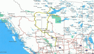
The Northwest Territories is bordered by Canada's two other territories, Nunavut to the east and Yukon to the west, and by the provinces of British Columbia, Alberta, and Saskatchewan to the south; it also touches Manitoba to the southeast at a quadripoint that includes Nunavut and Saskatchewan. The land area of the Northwest Territories is vast enough to be roughly equal to France, Portugal and Spain combined, although its overall area is even larger because of its vast lakes that freeze over in winter.
The name is descriptive, adopted by the British government during the colonial era to indicate where it lay in relation to the rest of Rupert's Land. It is shortened from North-Western Territory, which became the term North-West Territories.
In Inuktitut, the Northwest Territories are referred to as (Inuktitut syllabics ᓄᓇᑦᓯᐊᖅ), "beautiful land". The northernmost region of the territory is home to the Inuvialuit, who primarily live in the Inuvialuit Settlement Region (Inuvialuit Nunangit Sannaiqtuaq), while the southern portion is called Denendeh (an Athabaskan language word meaning "our land"). Denendeh is the vast Dene country, stretching from central Alaska to Hudson Bay, within which lie the homelands of the numerous Dene nations.
There has been some discussion of changing the name of the Northwest Territories after the splitting off of Nunavut, possibly to a term from an Indigenous language. One proposal was "Denendeh", as advocated by the former premier Stephen Kakfwi, among others. One of the most popular proposals for a new name—to name the territory "Bob"—began as a prank, but for a while it was at or near the top in the public-opinion polls.
Map - Northwest Territories (Northwest Territories)
Map


Country - Canada
 |
 |
| Flag of Canada | |
Indigenous peoples have continuously inhabited what is now Canada for thousands of years. Beginning in the 16th century, British and French expeditions explored and later settled along the Atlantic coast. As a consequence of various armed conflicts, France ceded nearly all of its colonies in North America in 1763. In 1867, with the union of three British North American colonies through Confederation, Canada was formed as a federal dominion of four provinces. This began an accretion of provinces and territories and a process of increasing autonomy from the United Kingdom. This widening autonomy was highlighted by the Statute of Westminster 1931 and culminated in the Canada Act 1982, which severed the vestiges of legal dependence on the Parliament of the United Kingdom.
Currency / Language
| ISO | Currency | Symbol | Significant figures |
|---|---|---|---|
| CAD | Canadian dollar | $ | 2 |
| ISO | Language |
|---|---|
| EN | English language |
| FR | French language |
| IU | Inuktitut |